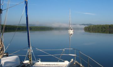
Calm morning in the Andaman Strait
Cruising Andamans
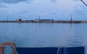
 Calm morning in the Andaman Strait |
The Andaman Islands comprise one part of India's eastern-most state, Andaman and Nicobar Islands. The Andaman Islands are situated in a roughly north/south line, about 400 miles northwest of Phuket, Thailand. Long known for their great coral and fish life, for snorkeling and diving, the Andamans have attracted cruising sailboats for years, as the capital is only a 3 day sail from the Similan Islands. Foreign boats (indeed foreigners traveling by any means) are restricted to certain parts of Andamans and are not allowed entry to the Nicobar Islands to the south. (See our Andaman Landfalls page for more on this)
Our cruising information was gathered during our 3 week sail through these islands in February and again in April of 2011.
Why Cruise the Andamans? First, the fishing is awesome, as there is no commercial fishing allowed. Second, it's a fascinating place -- Hey, it's INDIA, not Thailand or Malaysia, so it's different! The people are friendly, and while bureaucracy may put you off, a sense of humor, patience and a few side‑to‑side head‑wiggles will get you far. Third, well, that one has changed. One of the main attractions of the islands was their underwater beauty, but sadly, a massive coral bleaching in April 2010 has rendered the once lush coral landscape into gray coral graveyards. That being said, it is likely that the coral will regenerate (we were beginning to see it just 10 months after the bleaching) and the fish life is fantastic. You can snorkel with schools of 3' (1m) wrasse and graceful manta rays, right from your boat. We didn't dive, but it's likely the coral survived better at depth than in the shallows. Many of the islands are protected marine parks and you need special permission to go ashore there, or in the case of the mahatma Gandhi Marine park, you are not allowed to anchor. But there are still lots of anchorages and islands plus the fascinating Humphrey and Andaman Straits to traverse, taking you into the "interior" of the islands.
Cruising Guide: The only game in town is the few pages near the back of the
Andaman Sea Pilot
by O'Leary and Dowden, published by Image Asia
and updated every few years. It is available at chandleries in Malaysia and Thailand and
probably overseas. It has a few mud maps and write-ups on anchorages
both north and south from Port Blair but it's pretty minimal. Hopefully, what we write here
will augment that information, especially our anchorage information below.
Provisioning: There's a big (over 100,000) human population in Port Blair and they all need to eat so you can get what you need in terms of rice, flour, sugar, fresh fruits and vegetables. What you won't find easily is powdered milk. (It's also hard to find powdered milk without sugar in Thailand so Malaysia is a good place to stock up on this.) Beef is not available, the cow being sacred. You can get fresh chicken, but you may have to do the final plucking or deal with head and feet. We'd recommend arriving with any food stuffs that are remotely "interesting", including cheese.
Visas: Anyone on US, UK, Australian or European (and many others) passports must have a visa prior to arrival in India. Phuket, Thailand, is an easy place to apply for the visa. Emotion Travel (call Nui at +667 622 2320) in downtown Phuket town can make the arrangement smoothly. You will need passport photos and will need to leave your passport for about 10 days (more if there's a holiday in there). The cost is about $75‑80 for Australian and UK passports and $100 for Americans, presumably because of US aid to Pakistan. There are 2 things to remember:
For more info on the Andaman Islands, see the Noonsite's Andaman Islands page.
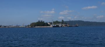 Pass Phoenix Bay & Chatham Is. to reach anchorage |
Preparation for Officialdom: Get a visa, as per above. Get a rubber boat stamp if you don't already have one. India loves official looking stamps! Unless you have a printer/copier on board, you'll need to create some letters and make photo copies of documents before you arrive in the Andamans. There are 4 bureaucratic entities to work with -- Navy, Customs, Immigration and Harbor Master -- and while they don't all want all your information, they can ask for it! Better to have too many copies than not enough. You may need 8 copies of your personal information (passport pages, etc), 1 for entering and possibly 1 for leaving for each of the 4 groups:
Yes, it's a lot of paperwork, but if you do it at anchor in Phuket or Langkawi, and then make the copies, you can arrive feeling well prepared.
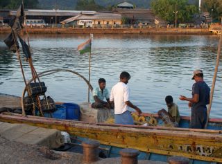 Local fishermen at the Chatham Is. Jetty |
Arrival: Port Blair, on Little Andaman, is the only port of entry to the Andamans. About 6 hours prior to arrival they want you to contact Port Blair Port Radio (PBPR) on 8.294 MHz (7am‑7pm India time) or 6.224 MHz from 7pm‑7am. By satellite phone they can be reached at +91 319 222 1675. If you have neither SSB nor satellite phone you can ask a buddy boat to call in your information or, at worst, you may have to wait to contact PBPR on VHF 16.
On approaching the harbor, call Port Blair Port Radio on VHF 16. You will be given permission to enter the anchorage and told to proceed to the quarantine/yacht anchorage which is west of Chatham Island. It is a large area, but a bit deep in places. Holding is good in mud unless you go too far north to the reef. This is far from the commercial ships and about 1 mile from the landing dock. You'll be in the company of other yachts, both entering and leaving. Once you are anchored, call PBPR on VHF 16 again to give them your exact Lat/Lon. Now the waiting begins.
Time your arrival for daylight, preferably as early in the morning as possible, to allow a full day for port clearance procedures. Plan to be sitting on your boat for many hours (if not 2 days) when awaiting clearance. Patience, patience, patience. India time is more slack than mañana time in South America.
The first to come by will be the Navy, and if you're lucky they'll be making the rounds of several yachts, and will have the Customs folks on board with them. Or customs may arrive in their own boat. Have your fenders over the side; these guys are good boat handlers but you never know. If no one comes out to you for several hours, don't be bashful about calling PBPR and gently asking them if the Navy and Customs are aware that they are there. Getting impatient or being impolite is very counter productive. Customs will take a picture of your boat and will probably look below. It is best to accompany them, and request just one go below with one of your crew.
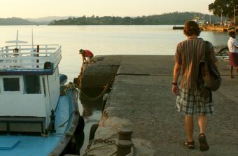 The dinghy dock, by the causeway, Port Blair |
A few suggestions for working with Indian officials: Do NOT offer anything to drink other than water. Politely refuse any requests for "gifts" of beer, alcohol, cigarettes, etc., and make sure they don't see any alcohol when they check your boat. When one yacht gives up booze to the officials it makes it harder for the rest of us. Do not tell them you have any Indian Rupees (even if you bought just a few dollars' worth from a cruising friend before arrival). Indian rupees are controlled, meaning you are not allowed to have any that you got anywhere except at an official bank or money changer. If you changed money to Rupees in Thailand before leaving, be sure to keep the receipt (or just keep quiet about them).
Once you've been visited by Navy and customs, let PBPR know that you are ready for Immigration. If it's now lunch time (loosely any time between 12‑3) have your own! PBPR will call you on VHF 16 to let you know when Immigration is on the dock. You need to take your own dinghy over to pick them up and bring them back to your boat, a distance of about 1nm. They may ask to be dropped on another boat after yours, or returned to the dock. The pick-up point is to the right (south) of the bridge to Chatham Island, at the small easternmost jetty shown in our Port Blair map. There are concrete steps there.
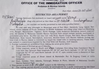 Restricted Area permit. Keep it handy. |
Immigration will do the passport/visa thing, and then issue you with a Restricted Area Permit which is a long form full of contradictory statements about where you (a foreign national) may and may not go. We advise asking questions. Keep this handy as it's the one paper you're most likely to be asked to show. Once you've been cleared by Immigration you are free to go ashore. Clearance is not finished, however, until you've been to the Harbor Master in Phoenix Bay. This can be done the following morning if need be. At the concrete wall/dinghy dock there are a couple boat boys who will tie and watch your dinghy. Tip what you want, but Rs30‑40 (less than a dollar) is probably fine. We did not use their services, preferring to lock our dinghy to the chains that hold the fenders along the wall. The trick here is to not be in the way of the local mini-freighters that also tie to the wall.
You can take a taxi to the Harbor Master, or walk along the harbor promenade until you get to the port gates at the head of Phoenix Bay, where you may have to ask for the Harbor Master's office. It's probably a 45 minute walk. Ravi is a reliable taxi driver who has helped yachties for years (phone +943 426 2030). He drives an old Ambassador taxi (the official taxi vehicle) and usually hangs out on the dock when not driving someone somewhere. There are also tuk‑tuk drivers in the area (walk to the end of the jetty, to the round‑about) but you will want to bargain with them on the fare before you get in.
Daily: You are required to radio PBPR twice a day with your location, either by VHF or SSB, once in the morning, and once in the evening. If you make an honest effort to do so, there will be no undue consequences upon your return to Port Blair to check out. We checked in when we could, which was about 1/3 of the time, and no comments were made. Certainly no effort was ever made to compare our itinerary to our reported location. One boat is permitted to make the call for others in the same anchorage. If you have ever chartered a boat you may be familiar with the twice daily check in procedure, and not find it too onerous.
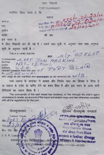 Official Papers! Port Clearance |
Departure Clearance Procedure: To clear out it's advisable to begin the procedure in the morning, if you plan to leave the same day. Start with the Harbor Master, and take a copy of your real itinerary with you -- but you will need to fill in their form, so it needn't be anything more than notes. The form DOES require dates in and dates out of each anchorage/port listed. Clearance fees are two-fold: there is a flat fee of about Rs32 per day for each day you are in the Andaman Islands. (It was actually a very bizarre number, like Rs32.14125/day, so it may be based on our tonnage, listed at 20 tons.) The other fee is for Port dues and is based on the number of times you enter a fee-based port. This is charged at a rate of Rs11.24/ton/single entry. We had 6 listed entries to ports (not including Hut Bay which we visited several months later) so we paid port dues of 6 x 20 tons x Rs11.25 = Rs1350 or $30. Net fees for 13 days in the islands and 6 entries to ports was Rs1950 or about US$43. You are not charged anything extra for the number of days you remain in one of the fee-based ports, but if you go in and out of Port Blair, Havelock, Chiryatapu etc, over and over you will pay higher overall fees than those boats that make a leisurely circuit of the islands without repeating ports. As of Feb 2011 the following anchorages we visited were fee‑based ports: Port Blair, Chiryatapu, Cinque Islands, South Rutland, Havelock Port Village 1, and Hut Bay. The following were non‑fee‑based anchorages: both ends of Homfray and Andaman Straits and Havelock Village 7. We do not have information on those anchorages we did not visit. It might be nice to have these fees posted somewhere so if you have more or better info, please let us know.
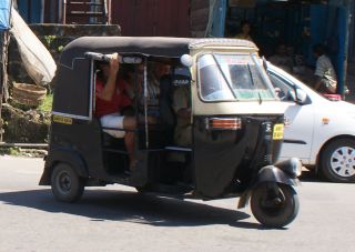 Grab a tuk-tuk to get around Port Blair! |
Once fees are paid to the Port Management Board (via the Harbor Master) proceed to Customs for clearance (with copies of the papers the Harbor Master gives you) then to immigration. Once this is done, you return to the Harbor Master for your onward Port Clearance. BUT, it's still not finished. Once you return to your boat, all ready to go, you have to request permission to leave the harbor. At this point all the officials will get their information together and affirm that you have dotted all i's and crossed all t's. It might take several hours. Once you receive the OK you can be on your way. Patience, patience, patience...
Time: India, despite its size, observes just one time zone throughout, meaning that the
Eastern-lying Andaman Islands experience a very early sunrise, and an early sunset. Set your watch
to GMT+5.5. Yes, that's 5 and a half (is India half an hour behind the rest of the world?![]() )
)
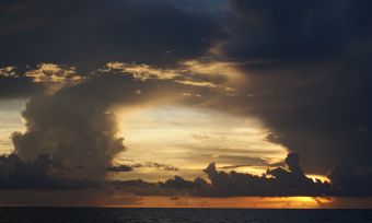 SW Monsoon squalls near the Andamans. |
Weather: There are 2 distinct seasons in the Andaman and Nicobar Islands: the Southwest Monsoon and the Northeast Monsoon. Monsoon is a word from Arabic mawsin, meaning season - it is not a storm. The SW Monsoon blows from April or May until November or December and this is the rainy season, and also the season when there might be cyclones in the Bay of Bengal (the body of water to the west of the islands, between them and India proper). It is not advisable to sail to the Andamans during the SW monsoon.
The NE Monsoon blows from about December to April and is the drier of the seasons, a great time to cruise the Andamans. It also gives a great downwind sail to the islands from Thailand, but a bit of a beat getting back (if there's wind at all). Leave yourself time at each end to chose your best weather window. In January and February winds are generally light and you might have to do a lot of motor sailing to get west. Then again, in February 2011 we had some good winds to the islands once we were west of Thailand's Similan Islands.
The Andamans are tropical (85‑95°F or 30‑35°C) with lower humidity than mainland SE Asia.
Money: The Indian Rupee is exchanged at a rate of about Rs44/US$. ATMs are available at in Port Blair, but no where else in the islands, so get what cash you need while in town when you first arrive. The only other places to spend money are the islands of Havelock and Maya Bandar, 80 miles north of Port Blair, where you can buy fresh fruits and vegetables, and enjoy a local meal for $2‑3.
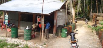 Petrol station, Little Andaman-style |
Fuel: Although there MAY be fuel at Havelock town or Hut Bay, Little Andaman, don't count on it. Best to get any fuel you need while in Port Blair. Taxi drivers (in their wonderfully ancient Ambassadors) will take your jugs to the station for you to fill. In May 2011 we paid about Rs36 ($0.82) per liter, and we gave Ravi, the taxi driver Rs350 ($8) for his time/services. In April we stopped to pick up fuel in Hut Bay, Little Andaman and encountered one of the more interesting petrol stations we've ever seen -- dozens of battered 55 gallon (200 L) drums piled high, and a few dozen standing on the ground ready to receive a manual fuel pump. It worked, though! We got our diesel and it was clean enough to get us to Thailand, although the bottoms of some jugs had rust sediment that we filtered or threw out.
Internet access: In 2011 we bought SIMs for both our phone and our 3G modem. The SIMs were identical and each came with about 1GB of data plus talk time, at a cost of about $10 each. Mobile phone coverage outside of Port Blair was spotty at best, and where we had mobile coverage we had internet, but only 2G speed. SIMs for BSNL (India's nationalized phone service) can only be bought at the BSNL office on the hill above downtown Port Blair, near the Police and Immigration offices. It's a very crowded, hectic space, but you want to make your way through the door on the left to the back room and ask for (wonderful) Vikram, who will give you a bunch of paperwork to fill out. You need 2 passport photos, and copies of your passport and visa page to get the SIM. Internet cafes can be found in "downtown" Port Blair and the speed is pretty good.
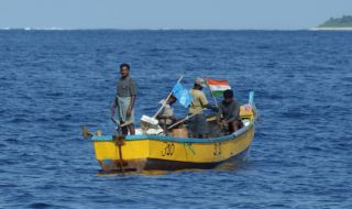 Indian fishermen often use floating nets. |
Obstacles and concerns: En route to Port Blair from Thailand you'll cross a few areas marked on the charts as rough water. If the wind is light you'll barely notice these upwellings, but if you have strong winds or winds contrary to the current it can get pretty uncomfortable for a few hours. Once in the islands themselves, its' pretty hassle-free. There is no commercial fishing in the Andamans, (which means that fishing is GREAT!) so at most you'll encounter small dug-out type canoes with a few fishermen in them. After the hassles of the Thai coast and the Strait of Malacca with crab pots, fishing boats and bamboo structures in the middle of nowhere, the Andamans are a breeze.
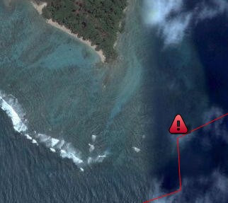 Our too-close reef encounter off Malay Island at the west end of Macpherson Strait |
The main concern in navigating the islands is chart accuracy (even using the 2009/2010 CM93 electronic charts). We encountered coral (as in, "Oh, $%#&!") on the southwest side of South Andaman Island (west of Chiryatpu, in the channel leading west) when the chart indicated that we had 10m (33ft) beneath us. Apparently the 2004 earthquake and tsunami caused the western shoreline to change.
Walking ashore we always felt safe, but in crowds we were vigilant of wallet/bags. Lock your boat, because minor theft is always a possibility, but no more so here than elsewhere in the world.
Cruisers: We are now publishing Downloadable Track Files in OpenCPN (.gpx) format and in MaxSea (.ptf) format (not all tracks are available in all formats yet - we're still working on it and they take time). You can download the track files either by clicking on the links in the tables below, or by clicking on the track in the Google Map below the table. The MaxSea files are in native format but the OpenCPN files are zipped so they download faster, and they need unzipping after they've been downloaded (which most operating systems do natively). If 2 files are shown, the smaller one has been edited to remove redundant points from straight tracks. This improves the speed of the download as well as performance once the file is loaded. Sometimes MaxSea Track files are separated from the Mark (chart notations) files. Download instructions are provided if you need them.
These files are provided free and we are actively soliciting cruisers to send us your track files so we can post them for others to download. If you would like to to participate, please email us your track files (as attachments to our HackingFamily account, not our Winlink acct) along with your boat name and draft. If you include your website and boat details, we'll link back to you from our Cruising Links page.
Disclaimer: While we always try to provide useful information, we can take no responsibility for its accuracy or usefulness. Prudent mariners will always navigate using all means at their disposal, and will not rely solely on electronic navigation.
Anchorages in the Andaman Islands:
The Google map and the table below show most of our anchorages and our route through the Andamans. The stop at Hut Bay, Little Andaman (southern most) was made on our return from the Indian sub-continent in April, when we pulled in for emergency fuel. They are organized in the order we visited, but you can make a loop in either direction. We chose to go north along the west side of the island chain to avoid headwind since it was the Northeast monsoon. All voyages must begin and end in Port Blair, and your time there both clearing in and clearing out are included in your allotted 30 days, so plan 2 days at the beginning and 2 at the end for that. But don't go running out of Port Blair without seeing the town and the historical museums and Ross Island. It's all very interesting and quite different from SE Asia!
Our journey took place in February 2011 (during the Northeast monsoon) except for our last anchorage, Hut bay, Little Andaman where is stopped in April, 2011. Note that the Google Map below will not save correctly if you save this page for offline viewing, but the rest of the page should be OK.
Andaman Islands Tracks
| Boat | Draft | Year | Comments | MaxSea | OpenCPN |
| Ocelot | 4.6' (1.4m) | 2011 | A Clockwise circumnavigation | 8 KB | 5 KB |
| Anchorage | Depth | North Latitude |
East Longitude |
Comments |
| Port Blair | 30' | 11°41.3 | 92°42.8 | Clearance port. Mud, some rock |
| Chiryatapu | 35' | 11°29.3 | 92°42.4 | Tuck in close to be protected from NE. Beware boulder. |
| Middle Cinque | 35' | 11°18.2 | 92°42.2 | A bit exposed to swell. Snorkeling good for fish viewing |
| South Rutland | 28' | 11°21.3 | 92°39.5 | Sand. Glorious beach. Turtle nesting beach. |
| SW Rutland | 32' | 11°23.0 | 92°35.4 | Sand. Long beach. Better protection than south Rutland. |
| Twin Islands | 28' | 11°23.6 | 92°33.1 | Sand. Strong currents in pass. Manta rays |
| NW end Andaman Straits | 30' | 12°17.3 | 92°44.7 | Mud. Tricky entrance, rocks appear at low tide. |
| Nilambur village | 20' | 12°10.0 | 92°45.7 | Day stop. Tucked into side of channel to visit village. |
| SE end Andaman Straits | 20' | 12°04.3 | 92°42.2 | Anchor on shoaling mud. |
| Havelock main port | 30' | 12°02.9 | 92°58.7 | Sand/mud. Small village ashore. Fruit/veg market inland. |
| Havelock Village 7 | 20' | 11°59.0 | 92°57.0 | Sand. Nice beach. Small resorts/restaurants ashore |
| Neil Island south | 28' | 11°49.5 | 93°01.4 | Pretty bay. Isolated. |
| Ross Island | mooring | 11°40.5 | 92°45.6 | Short stop to visit interesting historical island. |
| Hut Bay, Little Andaman | 20' | 10°35.6 | 92°33.4 | Sand/mud. Good holding inside breakwater. |
| Chennai Harbor, India (TNSA) | wall | 13°05.4 | 80°17.6 | Clearance port. Advance notice required. Heavy coal dust. |
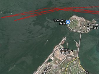 See a larger map of our Port Blair anchorage |
Port Blair, South Andaman Island 11°41.3N 92°42.8E |
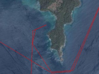 See a larger map of our Chiryatapu anchorage |
Chiryatapu, South Andaman Island 11°41.8N 92°42.0E |
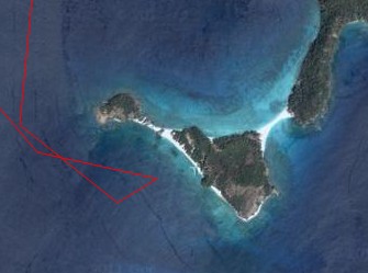 See a larger map of Cinque Islands anchorage |
Middle Cinque 11°29.3N 92°42.4E |
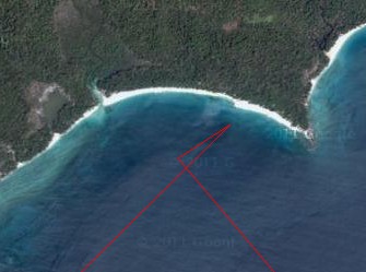 See a larger map of our Rutland SE anchorage |
Rutland, southeast anchorage 11°21.3N 92°39.5E |
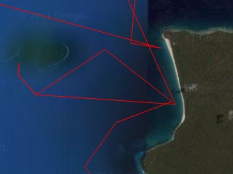 See a larger map of our Rutland, SW anchorages |
Rutland, southwest anchorage 11°23.0N 92°35.4E |
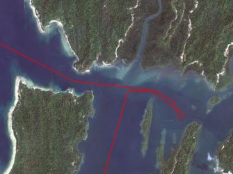 See larger map of Andaman Straits NW anchorage |
West end of Andaman Straits 12°17.3N 92°44.7E We did not traverse the Homfray Strait, as we needed to exit near Havelock, not farther north. We heard that it is possible to take a mast of about 20m (66') under the power lines on Homfray if you hug the southern side of the strait but we didn't want to risk it. There are no power lines to go under if you take the Andaman Strait, as we did. |
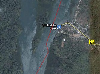 See a larger map of Nilambur Village |
Nilambur Village, in the Andaman Strait 12°10.0N 92°45.7E |
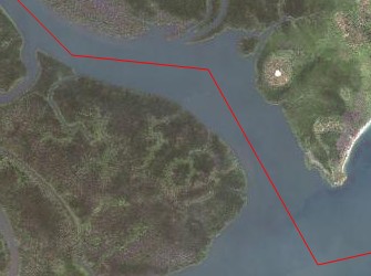 See a larger map of Andaman Straits SE |
East end of Andaman Straits 12°04.3N 92°42.2E |
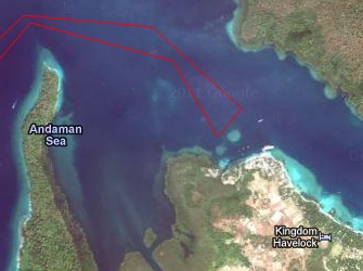 See a larger map of Main Havelock anchorage |
Havelock Island, main port 12°02.9N 92°58.7E |
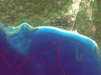 See a larger map of our Havelock #7 anchorage |
Havelock Island, Village #7 11°59.0N 92°57.0E The southwestern anchorage, however, was a different story. Although it's labeled as a "village" this anchorage has a couple small backpack resorts, some cafes, and an elephant stable for elephant rides! It was quite popular with the Indian tourists who seemed to be enjoying the beach. |
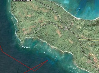 See a larger map of our Neil Island anchorage |
Neil Island south 11°49.5N 93°01.4E |
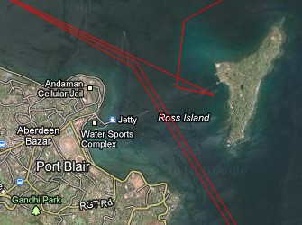 See a larger map of our Ross Island anchorage |
Ross Island approx. 11°40.5N 92°45.6E |
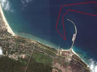 See a larger map of our Hut Bay anchorage |
 Inside the breakwater, Hut Bay, looking north |
Hut Bay Little Andaman Island 10°35.6N 92°33.4E
On our return from mainland India (Chennai) in April 2011, we were running desperately
short of diesel (there was little wind) so we diverted to Hut Bay. This is a tiny
village, but the anchorage is behind a massive breakwater, which is not shown on the 2010 CM93
charts but it shows on Google Maps!
There is a fair amount of commercial traffic (ferries, small
inter-island freighters) so you have to anchor well clear of their turning area.
Arriving here instead of Port Blair is NOT recommended unless you, too, have an
emergency! The inevitable wheels of Indian bureaucracy reached out to touch us, but
things were smoothed by having our Indian friends and the names of big-wigs to phone should we get in trouble! It also helped
that our Indian visas still had a few days of validity. But the point was to
get fuel - and we learned that the Hut Bay station was out of diesel. The nearest
place (short of sailing 70 miles north to Port Blair and re-checking in!) was 10 miles (16 km) up the
island. With a police escort, first to the one ATM and then to the "petrol station" we were
able to procure 425 liters of diesel. I put "petrol station " in
quotes because it consisted of a metal shack with dozens of battered drums piled on their sides,
and a few dozen upright drums from which an ancient manual pump was attached to dispense the
diesel. Quite fun, actually, and it was OK diesel (if filtered) and it got us
back to Thailand! This port is subject to entry fees.
See our information on Cruising into Chennai, and more about the city.
Indian Cruising Info:
Related Pages: India Home | India Newsletters | Sri Lanka Flora/Fauna
Cruising Info:
Top Level: Home | Destinations | Cruising Info | Underwater | Boat Guests | Ocelot | Sue | Jon | Amanda | Chris | Site Map | Make a Comment
|
If our information is useful, you can help by making a donation |
Copyright © 2000‑ Contact: Jon and Sue Hacking -- HackingFamily.com, svOcelot.com. All rights reserved.