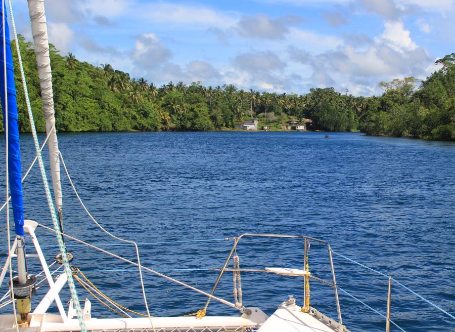
Ocelot in the channel to Noro, Vona Vona Lagoon
|
Cruising Info Pacific Cruising Info Related Pages Solomons Provisioning |
This page is a departure from our normal format, in that it has no thumbnail photos, but shows only the large versions of all photos, including satellite shots of our anchorages and approaches. This requires more scrolling, but means that you don't have to click on the thumbnails to see larger versions. It also makes it easy to store a local copy of this page to your hard drive, to reference even when you're offline. On most browsers, simply right-click on the text and select Save as... In Internet Explorer, click the gear icon in the upper right, select File, and Save as... This should save the entire page, with all internal links and photos preserved. Double-clicking on the saved file should bring the full page up in your browser. Enjoy!
Why Cruise the Solomons?
|
Our story: Ocelot arrived in the NW Solomon Islands in late March, 2019, coming down from Rabaul, PNG. We were lucky and were able to clear with Immigration in the Shortlands (just south of Bougainville, PNG) then took 4 days getting south to Gizo for final customs clearance. We cruised the New Georgia group of island for 4 weeks, then left Ocelot tied to the dock at Liapari, at the south end of Vella Lavella Island, the only boat yard facility in the Western Province. Rates were reasonable and we felt the boat was safe. On our return from the States in July we cruised farther SE into Marovo Lagoon. We and our cruising buddies (Soggy Paws) hauled our boats at Liapari for repairs and paint. Noel and Rosie Hudson, who own the whole island, are very personable and knowledgeable. Liapari became a home away from home for us.
|
Ocelot in the channel to Noro, Vona Vona Lagoon |
For this article, we provide information on the following subjects below:
| Money | Charts | Safety | Weather | Fuel | Shipping parts in | Anchoring Fees |
| Officialdom | Tracks | Health | Supplies | Internet | Hauling Out | Anchorages (31) |
Money: The Solomons use the Solomon Islands Dollar. In 2019, there were about SD8/US$, but ATM fees bring this down to about $7.78. Prices quoted in this article are converted to US$ at 8:1. The bills are in denominations of SD100, 50, 20, 10 and 5. There are coins for SD$2, 1, .50 & .20. It's a great idea to hit a bank and trade some larger bills for 20's or smaller if you plan to shop at the fresh markets, where change is often difficult to come by. Both ANZ and BSP banks have branches in Gizo, but Noro and Munda only have BSP. The ATM fee for BSP is SD45 (~US$5.50) per transaction, and you can usually withdraw up to SD4000 (~US$500). The fee at ANZ is SD70 (~US$8.75!) and we don't know their maximum because their fee put us off!
Officialdom: Immigration has more posts around the country than does Customs, which makes the clearance procedure a bit unclear. For those coming from the north (like we did) you can clear Immigration in Choiseul, or, with notice, in the Shortlands. But the immigration fee (US$12) can't be paid until Gizo or Noro. Also, customs can't be cleared until Gizo or Noro, meaning you're in a no‑man's‑land of legality until you reach Gizo or Noro. We understand there is the same issue when arriving from the south, that final clearance can't happen until Honiara. Immigration gives you 60 days with a visa on arrival, with the possibility to extend (for a fee) up to 6 months or even more.
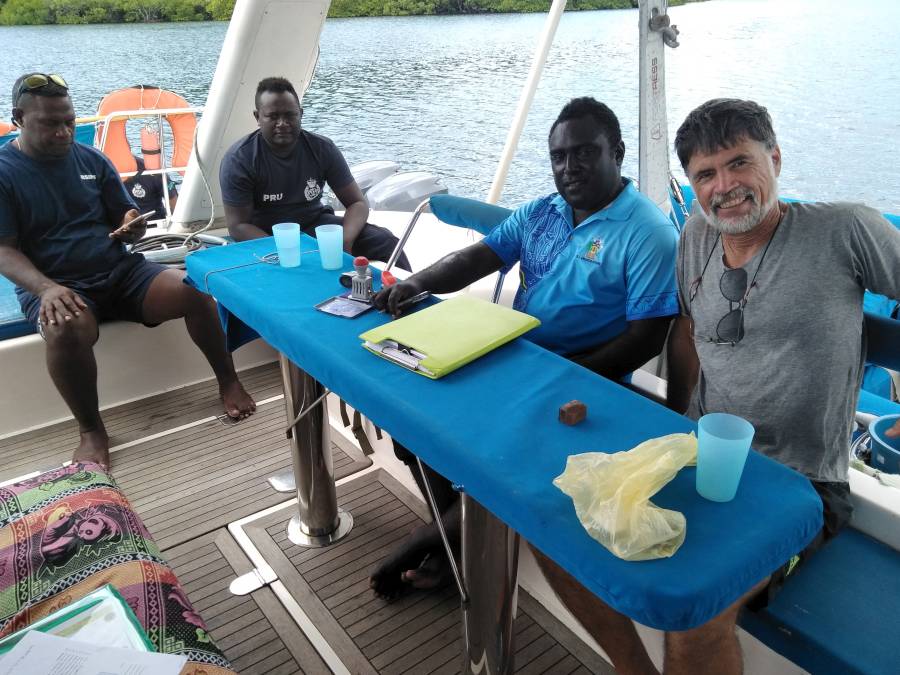 Police and Immigration aboard Ocelot |
In 2019 the Solomons increased their "light fees" for arriving foreign vessels to an unprecedented US$23 per FOOT of boat length. This makes customs clearance fees rise quickly into the hundreds of dollars. Ouch! We heard of one private yacht that complained in Honiara and had the fee reduced by half.
Gizo and Noro, 2 small towns about 25 miles apart, share the same Immigration officer, Mr. Billie. But he's stationed in Noro, and if you want to use his services to clear immigration in Gizo, you need to pay SD500 (US$63) to cover the cost of the boat for his journey to Gizo.
Bottom line: to do all clearances in one place, with minimal hassle, extra charge, or delay, plan to clear in/out in either Honiara or Noro. Of course, this is not very convenient for those of us who don't like to sail at night if we don't have to.
 Ocelot in Munda, Western Province SI |
There is no charge for clearing out, just a few pages of (duplicate) forms to fill out, and 2 offices to visit, first immigration, then customs. We were advised that we could NOT do customs clearance out from Noro, then proceed north to the Shortlands to complete immigration clearance there, as we wanted to do, heading north. Also, in keeping with their attempts to treat yachts like big (profit making) ships, they don't want you to stop after clearing out. This, of course, is unsafe for yachts, as we don't sail at night in reef strewn areas (like the Solomons) if we can help it. Luckily, they don't have the boats to enforce this silly rule.
A note on flying out and returning to your boat. Solomon Airlines, the only airline to serve the country internationally, will not allow you to board in Fiji or Australia with a one‑way ticket (even a return ticket such as we had) unless you have an out‑bound ticket, or a visa and letter from the Director of Immigration stating that you are returning to your boat and will leave the country by boat. Benzily Katsutaba (+677‑712‑3673), the Choiseul immigration officer, can get this letter & visa for you. If you apply for these documents while still in the Solomons, the cost is US$100, but there's no charge if you apply while out of the country. We did this from Australia a week before returning, and had fast, courteous service.
 Jon checks out the nose of a P39 wreck |
Benzily explained that he needed copies of the following:
Within 2 days of sending all this digital information, we received an email with a fancy attachment from the Director of Immigration, granting us permission to fly into the Solomon Islands on a one‑way ticket. This is what we produced at the Solomon Airlines ticket counter in Brisbane when asked if we had an on‑going ticket or a visa.
Charts: Like all of SE Asia, the navigational charts for the Solomon Islands are terrible - either displaced or low resolution or both. DO NOT TRUST YOUR CHARTS! Even worse, many areas, like Vona Vona Lagoon or Marovo Lagoon, have so many reefs (see screenshot below) that most commercial charts just say "Unsurveyed" and leave these areas blank. This is a real shame, as both lagoons offer rich cruising grounds.
 Navigating Marovo Lagoon Reefs safely requires satellite imagery |
To safely cruise the Solomons, you really need satellite‑based imagery. If all you have are iWhatsIts,
then get Ovital. But if you have a real computer that can attach to a GPS, there are better options. We make our charts from Google Earth (GE) and SAS Planet.
They're extremely accurate (maximum errors on the order of 10' or 3m, and most are much better than that) and very high resolution, as we make them at only
2000m elevation (for GE) or zoom level 18 (SAS) to get all the detail they have to offer. It's very comforting to know your charts are exactly
correct. Making your own charts (KAPs or mbTiles) is very time and bandwidth consuming (we have a HUGE amount of time and
effort invested in ours) but the tools are all free and we show you how on our
KAP Files page. Or, we've posted our own KAPs for cruisers to download.
These KAPs are huge, and we have to pay extra to provide this service, so we ask for a small donation (or make
a large donation ![]() ). They cover the
entire coastlines of most cruising areas from Micronesia and the Solomons in the east to the Maldives and Chagos. KAPs are a
MapMedia format which most computer‑based navigation programs can display. We typically use
OpenCPN, a free download, to display our KAPs and mbTiles, and we use a
COM‑port splitter to feed our GPS signal to both
OpenCPN and SAS (usually displaying ArcGIS or Bing imagery).
Displaying both programs side‑by‑side on a wide‑screen display gives the best of both worlds when dodging between
coral‑heads. We've also posted our sailing tracks through the Solomon Islands below, along with chart annotations and possible
additional anchorages.
). They cover the
entire coastlines of most cruising areas from Micronesia and the Solomons in the east to the Maldives and Chagos. KAPs are a
MapMedia format which most computer‑based navigation programs can display. We typically use
OpenCPN, a free download, to display our KAPs and mbTiles, and we use a
COM‑port splitter to feed our GPS signal to both
OpenCPN and SAS (usually displaying ArcGIS or Bing imagery).
Displaying both programs side‑by‑side on a wide‑screen display gives the best of both worlds when dodging between
coral‑heads. We've also posted our sailing tracks through the Solomon Islands below, along with chart annotations and possible
additional anchorages.
Cruisers: We are now publishing Downloadable Track Files in OpenCPN (.gpx) format and in MaxSea (.ptf) format (not all tracks are available in all formats yet - we're still working on it and they take time). You can download the track files either by clicking on the links in the tables below, or by clicking on the track in the Google Map below the table. The MaxSea files are in native format but the OpenCPN files are zipped so they download faster, and they need unzipping after they've been downloaded (which most operating systems do natively). If 2 files are shown, the smaller one has been edited to remove redundant points from straight tracks. This improves the speed of the download as well as performance once the file is loaded. Sometimes MaxSea Track files are separated from the Mark (chart notations) files. Download instructions are provided if you need them.
These files are provided free and we are actively soliciting cruisers to send us your track files so we can post them for others to download. If you would like to to participate, please email us your track files (as attachments to our HackingFamily account, not our Winlink acct) along with your boat name and draft. If you include your website and boat details, we'll link back to you from our Cruising Links page.
Disclaimer: While we always try to provide useful information, we can take no responsibility for its accuracy or usefulness. Prudent mariners will always navigate using all means at their disposal, and will not rely solely on electronic navigation.
Solomon Islands Tracks
| Boat | Draft | Year | Comments | OpenCPN |
| Ocelot | 4.6' (1.4m) | 2019 | NW only to Marovo Lagoon | 308 KB |
| Soggy Paws | 4.6' (1.4m) | 2019 | NW to the Florida Group | 261 KB |
Ocelot's 2019 tracks through the NW Solomon Islands, from the Shortlands in the NW through Marovo Lagoon and back

Safety: Crime is low in the Solomons, and although there have been reports of boarding of boats at anchor, these appear to have been opportunistic thieves looking for something of value on the boat. One of our flotilla anchored by themselves in the NE Shortland islands, and were accosted by drunk locals demanding money. They pulled up their anchor and left, but not before giving over about US$25, and having to whack the knuckles (with a winch handle) of some who tried hanging onto their boat as they left. They took pictures and turned them over to the Shortlands Police, who recognized most of them. In Cape Torokina (western Bougainville, so actually PNG) another of our flotilla awoke around midnight to a drunk local waving a knife in their cockpit and demanding to be let in. They called us on their VHF, triggered their loud siren, and turned on their cockpit lights, and he left, but our friends were scared by the incident. We are always careful to leave nothing of interest on deck (no fuel jugs, no dive gear), and we lock the boat at night while we sleep. We always have a blindingly bright spotlight inside, as well as several cans of pepper‑spray, to incapacitate any unwanted intruders. We have felt nothing but welcome from the people ashore or in towns. While the Solomon Islanders appear somewhat subdued compared to other Pacific islanders, they respond brightly to a smile and greeting.
| Is this useful? Buy us a beer! |
Health: Beware of small cuts or abrasions from coral or plants if you go hiking. Clean them immediately and watch for infection. All 8 of us adults got multiple tropical ulcers (usually on feet or legs) that required oral antibiotics to clear them up. There are no pharmacies in Western Province, so come prepared with your own stash of medicines. Your only recourse is to visit the hospitals in Gizo or Noro/Munda. Although the Solomons warns of malaria we found very few mosquitoes at any of our anchorages, and even when hiking. We did, however, use repellent when hiking or going ashore at dusk. Flies were more of a problem than mosquitoes, and sometimes we would have dozens on board when anchored near a village. Be extra careful hiking or diving. The Solomons are very isolated and help could be hours or even days away. Always carry your own needed prescriptions or those you might need in case of illness or infection.
Weather: The northwest winds blow through the island chain from Dec or January through April. The farther south you go, the more risk of encountering the edge of a cyclone during this season. From May until November the southeast Trades kick in with sometimes strong winds. Unfortunately, the South Pacific Convergence Zone often sits over the top of the island chain in July & August, bringing cloudy days, squalls, and even thunderstorms. But sunshine is plentiful between the squalls, and the tropical heat and moisture lets you know you're in the Tropical South Pacific! We tended to use Spot Forecasts or Windy.com, but we found these forecasting tools to be pretty inaccurate much of the time.
Supplies: We did not get to Honiara in 2019, so our information concerns only what is available in the Western Province and the small towns of Gizo, Munda and Noro. You can find some basic cheeses, and fresh butter. Frozen chicken wings are the most popular, but occasionally (and always at the Blue Container shop in Noro) you can find whole chickens or drumsticks, frozen. Blue Container store (in Noro) is like a mini‑Australian shop, and the prices reflect it, but you can find some bargains. They are the only place to find wraps (tortillas) and granola/cereal. At the ubiquitous Chinese shops you can get all the basics like flour, sugar, rice, salt, canned goods, peanut butter, detergent, soap, and other necessities.
 Colorful chaos of Gizo market |
At the fresh markets the main vegetables (other than the betel nut and lime) are long green beans, snake beans, bok choy, small green peppers (that was a surprise), tomatoes, sweet potatoes, and eggplant. Fruits are limited to bananas and papayas, with an occasional pineapple. "Nari" nuts (known to us from Indonesia as kenari nuts) are sold either whole, or shelled and roasted. Not cheap, but yummy nuts, good for snacking or baking. See our page on Provisioning in the Solomons and PNG.
Hard liquor, beer and wine are available. In Honiara you can get liquor duty‑free, but elsewhere it all seems to be the same price, so just shop where it's convenient. The 2 main beers, Solbrew and Canoe, come in a couple varieties. Alcohol is pricy, and beer is about US$1.50/can, but it's still cheaper than either PNG or Sorong (Indonesia).
There are a handful of general merchandise and hardware stores in Gizo, Noro and Munda. Island Enterprise in Noro is a good hardware shop (it's near the Blue Container shop), and in Gizo there is RTC and others on the main street. All 3 of these towns are TINY, with one street (although Gizo claims to be the 2nd biggest town in the Solomon Islands).
There are no pharmacies in Western Province. There is a new hospital in Gizo, and a small hospital in Munda. Try not to get sick! Bring all your RX needs with you!
There are not a lot of eating out choices in the west. In Gizo the go‑to place is PT109, right on the waterfront and with a little alcove to tuck your dinghy into when going to town. They are closed Sat/Sun, otherwise open for lunch and dinner. They have a bar and a short, but interesting menu that changes daily. In Munda there is a small cafe on the side street to the airport with tasty stir‑fry, and ice cream and coffee. In Noro there is a small restaurant beside the farthest north petrol shack (where we put the dinghies), that is mainly open for lunch. We have special ordered dinner, and it's cheap and yummy. Otherwise in Noro there is a nice Chinese restaurant in the big orange immigration building opposite the fresh market. Immigration is at the upper left, and the restaurant is at the lower right, down a short alley.
 PT109 Restaurant, Gizo, with a safe dinghy dock |
Fuel: Petrol sells at the waterfront in Noro and Gizo for SD10 (US$1.25)/liter. You can get it "pre‑mix" or straight, but pre‑mix is more common as most outboards here are 2‑stroke. Diesel can be bought at the fuel dock in Gizo for about SD9 (US$1.15)/liter, OR in Noro for only SD6.56 or US$0.82/liter from the big dock if you buy 200 liters or more. Call Alfie Nelson (+677‑740‑5607) to be sure the dock is free. Once a fishing boat comes alongside it may be occupied for several days.
Phones and Internet: Start by buying a SIM from Telekom. Then "top up" to over SD100 (US$13) if you want data. By pressing *155# you get a menu for buying data plans, or transferring money to friends. Both the 2‑week 1.6 GB plan for SD100 (US$12.50 or $7.81/GB) and the 1‑month 3.5GB plan for SD220 (US$27.50 or $7.86/GB) are the best we found. Of course, if you're like us, you go through the data way faster then the expiry date! DON'T let the data run out (you can check your balance at *155#) or they will start to pull straight money off the phone very quickly. It's OK to re‑buy a new data plan before the old one runs out. You don't lose the old data, and the phone company will decrease that data first, before touching the new plan.
Shipping boat parts to Solomons: We needed some Yanmar saildrive parts after we bumped a reef in Redova, and hauled out at Liapari. It was surprisingly easy to organize. We dealt with Yanmar dealers in both Singapore (Patrick Yam at CLLS) and Australia (Minards Diesel, NSW). The problem is that DHL really only goes to Honiara. The good news is that the DHL agents in Honiara, BJS Agency, will forward your package(s) on to you (for a fee) if you let them know.
Items should be sent via DHL to the following address:
Yacht [Your Yacht Name] IN TRANSIT
c/o BJS Agency Ltd.
Commonwealth Street
Honiara, SOLOMON ISLANDSAttention: Captain [Your name]
If you need to collect packages outside of Honiara, call Judy at BJS in Honiara (+677‑23532). Judy is an ex‑pat Australian who's very helpful and will clarify the procedure. Basically, BJS will pick up packages at Honiara airport (still called Henderson Field, as it was during WWII) and if you're not in Honiara they will arrange for them to be transshipped to any other destination that Solomon Airlines flies to. We had ours sent to Gizo. Customs respects "In Transit for Foreign Yacht" so you shouldn't have to pay any duty, but you will have to pay the transshipment fee, which Judy was gracious enough to trust us with even after she'd sent the packages on to us. For 4 kg of parcels we paid SD260 (US$32.50) into the DJS bank account to receive them in Gizo. The office for Solomon Airlines in Gizo is on the main street, to the left of the Gizo Hotel, and is open 7 days a week. They held our packages until we could arrange transport from Liapari to collect them.
To pay for parts from vendors who don't accept credit cards, we've found the TransferWise service to be excellent. Not quite as good as just using a credit card, but minimal fees and the money goes into their bank account quickly, usually within 24 hours. Highly recommended.
Haul out and Boat Moorage: Yacht‑friendly Liapari is the best game in town. Located at the southern end of Vella Lavella, 300 acre Liapari Island is owned and run by ex‑pat Kiwi Noel Hudson (+677‑749‑6021). Noel and his wife Rosie are gracious hosts and welcome yachts to their beautiful, fully protected anchorage. You can leave your boat at their dock for a very reasonable fee. Or you can haul out for repairs or painting. They can take monohulls and catamarans, but check with Noel first about availability. He has 2 slipways, but the small one is too narrow for catamarans, and he has no way to move boats off the railway. So it's one at a time. They can do a power‑wash, help with mechanical issues (he has a good mechanic), welding, and general help like painting using his staff of workers.
 Ocelot hauled out at Liapari, near Gizo |
Anchoring fees: Some villages claim that they own the water and try to charge boats to anchor. Unfortunately, some large yachts have paid these "kastam" fees, which sometimes start at ridiculous amounts like SD800 (US$100) per night, so the villagers demand the same of small yachts. The problem is that paying anything will simply perpetuate this practice. It is always best to be friendly but firm that we don't pay to anchor, and that we were told by government officials that there are no official anchoring fees and we are not to pay fees as it's bad for tourism. If that doesn't work, ask to see some official paperwork that authorizes the person to accept anchoring fees, and that they own the land (water) and they can provide an official receipt. As a last resort, ask to go ashore to speak to the chief. If it comes to that, take gifts of sugar, canned meat or tuna, cloth, fishing gear or whatever, and be prepared to thank the chief, in advance, for his permission to anchor there. This is very similar to the Fijian custom of sevu‑sevu.
Anchorages: The table below, with the more in‑depth comments below that, lists all 31 anchorages we visited on our way through the Solomon Islands, listed NW to SE. The anchorage links go to the in‑depth comments below. We've now added satellite shots of each anchorage, with our track in and out (our anchorage is usually pretty obvious from the track). These are much better than mud maps! Depths are in feet, distances are in nautical miles, latitudes are all south, and longitudes are all east. As always, if you have questions or comments, please contact us - we'd love to hear from you!
| Date 2019 |
Anchorage | Area | South Latitude |
East Longitude |
Depth feet |
Cell | Comments |
| 19 Mar | SE Shortlands | Shortlands | 7º04.82' | 155º52.82' | 45' sand | Yes | Very temporary |
| 20 Mar | Shortlands Police station | Shortlands | 7º04.65' | 155º51.37' | 50' mud | Weak | Safe & secure |
| 24 Mar | Nuhu village | Shortlands | 7º06.40' | 155º97.74' | 14' sand | No | Joseph's village, friendly |
| 22 Aug | Stirling Island | Treasury Is | 7º24.78' | 155º32.89' | 42' mud | No | WWII airstrip & PT base |
| 21 Aug | Vatoro Bay | Vella Lavella | 7º41.11' | 156º30.24' | 60' mud | No | |
| 26 Mar | Surepelo Pt (Sandfly Bay) | Vella Lavella | 7º45.13' | 156º34.59' | 45' mud | Weak | Protected. Overnight stop only |
| 21 Aug | Sand Bank | Vella Lavella | 7º54.02' | 156º39.17' | 31' sand | Yes | Lunch stop in settled weather |
| 14 Aug | Bega (Mbava) | Vella Lavella | 7º49.00' | 156º33.59' | 65' mud | Yes | Protected, good diving |
| Many | Liapari | Vella Lavella | 7º56.83' | 156º42.79' | 57' mud | Yes | Protected, friendly, 8' pass |
| 31 Mar | Loga Island | Gizo | 8º05.41' | 156º50.50' | 60' mud | Yes | 0.7nm from town |
| Many | Gizo Town | Gizo | 8º05.98' | 156º50.34' | 42' mud | Yes | Off PT109 restaurant |
| 1 April | Epangga (Apanga) Island | Gizo | 8º06.69' | 156º52.40' | 50' sand | Yes | Some boats asked to pay to anchor |
| 2 April | Fat‑Boys Resort | Gizo | 8º07.54' | 156º54.03' | 60' sand | Yes | Settled weather only |
| 2 April | Vona Vona Lagoon | Vona Vona | 8º11.94' | 157º04.90' | 30' mud | No | Convenient at the time |
| Many | Boboe Village | Vona Vona | 8º09.09' | 157º05.58' | 50' mud | No | Friendly village |
| Many | Lola Island Resort | Vona Vona | 8º18.39' | 157º09.77' | 26' sand | Yes | Very protected, nice beach |
| 27 July | Nununggara Is | Vona Vona | 8º17.67' | 157º12.28' | 57' mud | Yes | Protected |
| Many | Noro | Vona Vona | 8º14.46' | 157º11.75' | 33' sand | Yes | Diesel, provisioning, clearance |
| Many | Munda | Vona Vona | 8º19.93' | 157º16.14' | 38' sand | Yes | Tricky entrance, provisioning, dive shop |
| 19 July | Egholo Bay | Rendova | 8º24.83' | 157º22.37' | 58' mud | Weak | Hikes to swimming hole & crashed plane |
| 20 July | PT109 Bay | Rendova | 8º24.61' | 157º19.70' | 55' mud | Weak | Lots of WWII stuff |
| 12 July | Viru Harbor, Tetemara | New Georgia | 8º29.64' | 157º44.00' | 55' mud | Yes | Very protected |
| 13 July | Seghe | Marovo | 8º34.58' | 157º52.82' | 33' coral | Yes | Currents, P‑38 off end of runway |
| 13 July | Mase Islands | Marovo | 8º30.64' | 157º55.86' | 38' mud | Yes | |
| 14 July | Pelevo Island | Marovo | 8º29.17' | 158º05.51' | 18' rubble? | Yes | Lunch stop, nice snorkeling |
| 14 July | Lumalihe Island | Marovo | 8º27.77' | 158º03.56' | 18' sand | Yes | Lovely, excellent protection |
| 15 July | Telina | Marovo | 8º31.37' | 158º04.11' | 45' mud | Yes | |
| 15 July | Checke | Marovo | 8º31.50' | 158º05.02' | 45' mud | Yes | |
| 16 July | Sarumara | Marovo | 8º79.28' | 158º08.89' | 24' sand | Yes | Good protection, nice snorkeling |
| 18 July | Uepi Resort | Marovo | 8º25.72' | 157º56.81' | 15' sand | Yes | Carvers come Thursday |
| 18 July | Mindeminde Islands N | Marovo | 8º29.37' | 157º54.72' | 40' sand | Yes |
| Is this useful? Buy us a beer! |
|
SE Shortlands, Shortlands, 7º04.82'S 155º52.82'E, 45' sand, Weak cell The Shortland Islands look like they should be part of Bougainville (PNG) but they're really the NW‑most islands of the Solomons.
We were originally hoping to anchor in a small atoll just NW of the Shortlands (Tuluve Island on our CM93 charts) but we couldn't find anchoring depth there. Our friends on Berserker had been attacked by drunken locals at their anchorage in the NW corner of the Shortlands, so we elected to sail all the way around to the more populated SE side, even though it would mean arriving after dark (we'd come down from Cape Torokina that day, about halfway up Bougainville). Luckily, the anchorage presents no real hazards when approaching from the north. Just nose in until you find anchoring depth. But we would class this as an emergency, calm‑weather only anchorage, as the Shortlands offers many nicer and more protected anchorages. There are no supplies beyond local vegetables. You can buy phone top‑ups in town, but not SIMs.
Return to Top Return to Anchorage Table |
|
Shortlands Police station, Shortlands, 7º04.65'S 155º51.37'E, 50' mud, Weak cell Early on the morning after our 9pm arrival at SE Shortlands (above), 2 police boats greeted us and asked us to follow them to the anchorage in front of the police station for clearance, since Benzily, the immigration officer from Choiseul, was there. He came out to the boats and cleared us all in quickly and cheerfully, which was a pleasant surprise.
This is actually one of the better anchorages in the Shortlands. It's protected from all directions, has no currents, offers lots of space, is close to several wrecks to dive on, and it's very safe. The approach is easy coming up the channel to the NE. Going through the gap to the SE one should favor the SW side, as a sandbar extends SW from the small island to the east. There are several wrecks in the main bay to the south, including some of the big Japanese float‑planes against the southern shore. Perhaps even better is to take a trip out to Balalai Island, 5nm to the NE. The old Japanese runway there is still used, and there are LOTS of WWII planes (& bits of planes) there. Someone apparently tried to collect them all in one place to put up a museum, which makes examining them convenient. Unfortunately, they didn't finish the project, so most of the planes are out in the open and deteriorating. But there are several 2‑engine Betty bombers as well as a mostly intact Zero and lots of engines and other bits and pieces.
Return to Top Return to Anchorage Table |
|
Nuhu Village, Shortlands, 7º06.40'S 155º97.74'E, 14' sand, No cell One of our local visitors was a man called Joseph, and he invited us to his village of Nuhu for dinner. Getting there was reasonably straightforward, although all of our satellite imagery is obscured. There's a reef to avoid that sticks out to the west as you come around the corner, but that shows on the satellite view. The rest should be done in good light. There's a reef in the middle of the bay, but it's easy to see and avoid if you hug the coast. It actually might have been easier (& shorter) to take the channel over the top of Magusaiai Island, but an election was pending and the village had strung a banner across the channel (which is probably gone by now).
Unfortunately, Joseph hadn't checked with the leaders of his village, and the dinner never materialized. The villagers were friendly, but our only activities were to explore the northern channel by dinghy, although the reefs looked inviting.
Return to Top Return to Anchorage Table |
|
Stirling Island, Treasury Islands, 7º24.78'S 155º32.89'E, 42' mud, No cell The Stirling Islands hosted a fairly large air‑base and PT base during WWII, and many relics are still around (although no PT boats, as they were mostly plywood). You can enter the inner lagoon through any of the 3 gaps to the NE with good light, but the northern‑most is a bit tricky, as a reef sticks out to the east. The middle pass has 20' (6m) and the southern pass about 35' (11m). The anchorage provides room for several boats and is completely protected. When we were there in 2019, there was a weak cell signal from the tower above the village on Mono, but no data.
Roy (Junior) apparently owns much of the area, and can give an interesting 4 hour tour to many of the WWII relics, including a HUGE pile of WWII Coke bottles, 2 Avenger torpedo bombers, a twin‑engine P‑38 Lightning, a junk‑pile, the airport, a nice viewpoint, etc. When entering, it's considered polite to stop west of his village on the small peninsula that sticks south from Mono Island and ask his permission to anchor, and to arrange a time to pick him up for the tour. Trade items are often more valuable to them than money, and we gave some to the village chief as well. The anchorage itself is beautiful, with lots of coastline to explore and lots of birds filling the air with their songs. We arrived in brisk SE winds after a long 60nm sail from Vella Lavella, and were happy to find such a well protected anchorage. It's 1.7nm from town so not many locals come out that far. Those who did were courteous and friendly.
Return to Top Return to Anchorage Table |
|
Vatoro Bay, Vella Lavella, 7º41.11'S 156º30.24'E, 60' mud, No cell
Vatoro Bay was really just a convenient anchorage on our way to Stirling Island, 60nm to the NW. We entered coming up from the south, between the fringing reef and Vella Lavella, which should really only be attempted with good light or satellite‑based charts, as there are few reef markers and at least 2 narrow bits. Our exit through the fringing reef was much easier. The bay is relatively deep, but 2‑3 boats can anchor there. The cell signal was too weak to use, and there were no villages nearby. There are several other bays along this NW side of Vella Lavella that should also provide good anchorages.
Return to Top Return to Anchorage Table |
|
Surepelo Pt (Sandfly Bay), Vella Lavella, 7º45.13'S 156º34.59'E, 45' mud, Weak cell Again, this was just a convenient place to anchor as we were coming south towards
Liapari. We'd originally planned to anchor further north, but we'd
made better time than expected so we pushed on. Approaching the bay is straightforward as
long as you avoid the reef at the mouth of the bay. The bay is huge and very well protected,
and can host many boats. Although there are several villages nearby, nobody came out to us,
but we only stayed the one night. Contrary to the name, we saw no flies.
There appeared to be several logging operations raping and pillaging Solomon's natural resources, but none of them were active when we were there. We saw many logging operations while we were in the Solomons, and it made us sad to see the locals selling their children's inheritance. We saw posters in Munda telling the locals (in Tok Pisin, their national language) not to sell their trees.
Return to Top Return to Anchorage Table |
|
Sand Bank, Vella Lavella, 7º54.02'S 156º39.17'E, 31' sand, Cell This anchorage is small, but the approach is easy and the bottom seemed like good sand. Still, we'd class it as a day‑anchorage only unless conditions were very settled. The sand fan anchorage is just big enough for 2 boats, but Sue and Sherry from Soggy Paws remained on board to keep an eye on things. The boats often swung towards each other as the currents shifted them around.
We stopped here for a short hike up the hill to see a WWII DC‑3 (R4D) that crashed into the mountain with 22 passengers aboard. There's lots of wreckage, including both engines, and one wing still has the US insignia. There's also what appears to be the remains of a Japanese Zero down by the water. From here it's also possible to visit Yawana Dive resort, which lies about 1 mile further south, and has no anchorage. Andrew, the owner, can take up to 4 divers out in his powerboat, and he knows some nice dive sites nearby. A sea mount north of Bega Island was newly explored by ourselves and Soggy Paws (with Andrew), and we declared it worthy of more dives. It is now on his list as "Two Cat Reef" in honor of our 2 catamarans.
Return to Top Return to Anchorage Table |
| Is this useful? Buy us a beer! |
|
Bega (Mbava), Vella Lavella, 7º49.00'S 156º33.59'E, 65' mud, Cell This anchorage is on the eastern side of hilly Bega (aka Mbava) Island, and has good protection in all seasons. Entering from the SE presents no real problems. You can also come down from the little bay to the north if you're careful, as the reef has 18' (5m) over it. The southern bay got deeper to the SE, so we anchored as soon as the bottom showed smooth mud. We anchored here during the SE season and although the wind came in, the sea swell did not, as a fringing reef blocks it. Soggy Paws anchored SW of tiny Inia Island, but we chose the smooth mud and somewhat deeper area south of the coral finger in the southern bay. The cell tower on Bega is visible from the anchorage and provides good data.
We awakened on our first morning to the surprising sight of a 10' (3m) crocodile, just lounging on the surface, not 20' (6m) behind Ocelot. OK, No Swimming. Birds are plentiful here, with blue and white Beach Kingfishers perched on low mangroves, and pigeons and red Cardinal Lories in the coconut palms on Inia Island. There is some history to Inia: it was owned by a German whose wife and child were murdered in 1902 in a random act of retribution, but he remarried, stayed on the island and raised another family, setting up a dock and a local trading post. The remains of the family home, and the family cemetery plots, are still there to be seen.
Return to Top Return to Anchorage Table |
|
Liapari, Vella Lavella, 7º56.83'S 156º42.79'E, 57' mud, Cell Approaching Liapari is pretty straightforward. The reef to the north is not marked, but the reef to the south that one turns around has a red pole. Getting into Liapari involves going through a well marked gap in the reef, blasted out by Marines during WWII. It usually has at least 7' (2m) of water over it, but if we see reef exposed on both sides of the channel then we anchor in the SE corner of that bay until the tide returns. Once inside, there's a huge anchoring area, but watch for the reef to the east. If you don't want to anchor, there are 1‑2 moorings available, or you can tie bow‑in to the dock, with stern‑lines to buried moorings.
Noel (+677‑749‑6021) and Rosie Hudson own 309 acre Liapari Island. They're knowledgeable and welcoming to yachts. Noel is quite energetic and has his fingers in many pies, the latest of which is a Noni plantation and processing station, which should bring more money to the locals. But he also has the only yacht‑friendly dock for leaving a boat, and 2 slipways for hauling, one for monohulls (only) and the other for much larger boats (and cats). We had saildrive problems and were able to employ Noel's mechanic, Peter, who worked with Jon to move the engine(!) forward 8" (20cm) so we could get to the bearings and seals on the input shaft of our saildrive. Peter was able to drift the old bearings out safely and competently, and then use the massive hydraulic press to put the new bearings in place. Noel has a fairly extensive machine shop, and helpful, qualified machinists. He even has a MIG setup for welding aluminum.
In August 2019, we hauled Ocelot on the big railway, a fairly long and complicated process, but then Noel cut us a deal on staying on the hard longer than expected when we found we needed more saildrive parts flown in from Singapore. At present, cats are lifted on their keels if they don't mind being at an angle, or under their bridge‑decks if they want to remain level, but Noel's planning to build a ramp so cats can be lifted on their keels but stay level.
Note that Noel does very little to haul boats except to drive the winch. It's up to boat owner to find where your boat can be supported and to place the supports appropriately. His workers will happily help, and will cut whatever blocks or wedges or carpeting are needed, but Liapari assumes no liability for lifting your boat, and they don't have much experience with cats (I think we were #5). We lifted out from our bridge‑deck, but then used blocks, wedges, and sledge‑hammers to take as much weight as possible on our keels. Noel has no way to pull the cars down the tracks, so launching happens rather ... abruptly. Noel and Rosie enjoy 5pm sundowners with visiting yachts at their covered BBQ spot just to the north of their dock. He recently started a tradition of cooking pizzas at noon on Sundays. He provides the crusts, and the yachts supply the toppings. There is also a building with toilet, cool shower, and big wash sinks for doing laundry, and 3 complete bungalows if you don't want to stay on your boat. Every Friday women come from a village on Vella Lavella to sell fresh produce. Big pineapples, green peppers, tomatoes, whatever they have grown. The prices are better than in Gizo. Transport can be arranged to both the airstrip and Gizo town by powerboat on a day‑rate basis, or you can ride with Noel on his weekly Thursday jaunt to town for less. Oh, and the birding and walking is great!
Return to Top Return to Anchorage Table |
|
Loga Island, Gizo, 8º05.41'S 156º50.50'E, 60' mud, Cell Getting in to Gizo involves winding between numerous reefs, and satellite imagery is extremely useful. Approaching Loga from the north, there are numerous poles showing where most (but not all) of the reefs are, but there's a small, unmarked reef just to the NW of this anchorage that you can see in the satellite photo that needs to be avoided. The approach from the south is somewhat easier.
On our first visit to Gizo we had 4 boats in our little flotilla and we decided to anchor here, about 0.7nm from town, because we'd heard of boats being boarded while anchored off town. Like many rumors, the ugly ones seem to go the furthest and the fastest. We later anchored off Gizo Town for several days with no problems, so our fears probably weren't fully justified.
This is a protected anchorage with good holding, but it is not as quiet as it would seem. Apparently this is a popular place for the local transport boats (ferries) to pull in to let their customers go ashore to pee! Perhaps Gizo is short on public toilets (we used the ones at PT109 Restaurant, but we ate meals there). We decided not to go ashore to investigate. But it does mean there is a pretty steady stream of powerboat traffic in the morning and evening. Return to Top Return to Anchorage Table |
|
Gizo Town, Gizo, 8º05.98'S 156º50.34'E, 42' mud, Good Cell The classic anchorage in Gizo is in the protected bay within sight of the PT109 Restaurant and Bar. There are no problems approaching except the general issues of navigating the jigsaw‑puzzle of reefs to get into the Gizo area in the first place. The first time we anchored here we were concerned about leaving our boat unattended while we had dinner, so we anchored such that we could watch her while we ate at PT109. The restaurant is only open on weekdays but has delicious food, large servings, and a nice choice of seafood or burgers or fish soups. And cold beer! You can leave your dinghy tied to the inlet walls right by the restaurant.
PT109 is at the western end of Gizo, next to the fuel‑dock and a banana‑boat builder (who is considering importing epoxy), but it's a pleasant walk along the one main street to get to a number of hardware stores, grocery stores, the public market, ANZ & BSP banks, and the offices for Customs. If you need to clear in with immigration here you have to contact the office in Noro and pay SD500 (US$63) for the Immigration officer (Billy) to take the boat over from Noro to Gizo. The "Yamaha shop" carries a number of hardware items and also frozen meats, and some imported food. Nearby in the "Bulk Store" you can find cheese, butter, more frozen chicken, plus baking goods in bulk. Chicken is always frozen, but usually just legs or wings. At the eastern end of town is the Gizo market and the Gizo hotel. The hospital (a tall new, white building) is located at the far eastern end of town.
Return to Top Return to Anchorage Table |
| Is this useful? Buy us a beer! |
|
Epangga (Apanga) Island, Gizo, 8º06.69'S 156º52.40'E, 50' sand, Cell The satellite image shows a lovely rectangle of sandy protection inside a shallow reef, just east of Epangga Island. For settled weather, this is a lovely place with clear water. The cut is 110m wide, so make sure you anchor as close to the middle as possible unless the wind is very constant.
Unfortunately, some large yachts have caved to the demand to pay a "kastam" fee to anchor here, an extraordinary amount of SD800 (US$100) per night, so the villagers sometimes try and demand the same of small yachts. It is always best to be friendly but firm that we don't pay to anchor, and that we were told by officials that there are no official anchoring fees and we are not to pay fees as it's bad for tourism. If that doesn't work, ask to see some paperwork that authorizes the person to accept anchoring fees and that they own the land (water) and can they provide an official receipt. As a last resort, ask to go ashore to speak to the chief. If it comes to that, take gifts of sugar, canned meat or tuna, cloth, fishing gear or whatever, and be prepared to thank the chief, in advance, for his permission to anchor there. The upscale Sanbis Resort just to the SE on Mbambanga Island doesn't want kids ashore, but they do have a dive operation. There's a sunken fishing boat just outside their dock, marked with buoys.
Return to Top Return to Anchorage Table |
|
Fat‑Boys Resort, Gizo, 8º07.54'S 156º54.03'E, 60' sand, Cell Fat Boys is well known as a yacht‑friendly resort, with a bar and restaurant at the end of their long dock and some paths to wander ashore. Unfortunately, it's all pretty deep &/or coral on the bottom, so not many choices for a good anchorage. There is sand inside the arc of pretty reef to the SE, and we anchored there for lunch, but the sand slopes steeply enough that we'd class this as a settled‑weather anchorage only. We stopped for only a short recon ashore, then moved on into the protection of Vona Vona Lagoon for the night.
In north or east winds, a better (shallower) anchorage can probably be made on the SW side of the island, at about 8º07.52'S 156º53.36'E or possibly 8º07.75'S 156º53.81'E. Getting into this long, thin bay involves a narrow gap at the western end that shouldn't be attempted without good sunlight and satellite charts. Unfortunately, this bay does not offer an easy way to get ashore. When we talked to the folks in the restaurant, we tried to encourage them to put in a few moorings to encourage more yachts to visit. If more folks do this, they may actually do something. Ask the resort about snorkeling the reefs, and enjoy the birds ashore, too!
Return to Top Return to Anchorage Table |
|
Vona Vona Lagoon, Vona Vona, 8º11.94'S 157º04.90'E, 30' mud, No cell Most charts show all of Vona Vona Lagoon as "unsurveyed" and provide only minimal information of dubious quality, but we found the extremely numerous bommies and mud‑flats pretty easy to negotiate with satellite imagery, and we wouldn't attempt to navigate in the lagoon without it. Where we stopped was really just an anchorage of convenience, a shallow mud‑bank off to the side of the main channel.
There's a village just south of the anchorage, and that evening several carvers visited us, wanting to sell their wares. This is extremely common in both Vona Vona and Marovo Lagoons. These carvers were actually from Boboe Village to the north, and they invited us to visit. One of them was Rena Billy, who acts as a tour‑guide and boat operator, and we worked with him for several fun expeditions. As with most anchorages inside the lagoon there is NO swimming. Crocodiles patrol the area and are the top of the food chain. Just as well, for the water in much of the lagoon, while clean in terms of debris and trash, in neither clear nor appealing.
Return to Top Return to Anchorage Table |
|
Boboe Village, Vona Vona, 8º09.09'S 157º05.58'E, 50' mud, No cell We've only approached Boboe village from the south (Vona Vona Lagoon) but one can also come through from Blackett Strait by using the 8' or 2.5m deep cut in the reef 0.3nm NE of Boboe. The entrance from the south is all deep and less nerve‑wracking, but only useful if you're already in the lagoon.
The villagers in Boboe are welcoming and Rena Billy seems to be the town's guide and spokesperson. He can arrange to take you in his open speed boat to WWII relic sites, (tanks, hospital caves, wreck diving), or on jungle walks for birding and waterfalls on Kolombangara. We negotiated his pay at about SD100 (US$12.50) per half day, with some trade goods thrown in. Rena Billy (+677‑743‑6577), an older Billy, Tony, and other men in the village are good carvers and have fair prices for their workmanship. We came here before we went to Marovo Lagoon, and we later realized that finer workmanship (and higher prices) are often found in the villages of Marovo. Boboe has a primary school, a small soccer field, and welcomes yachtie families to visit and interact. We were not bothered by many canoes to our boats, probably because we were already in touch with Rena Billy.
Return to Top Return to Anchorage Table |
|
Lola Island Resort, Vona Vona, 8º18.39'S 157º09.77'E, 26' sand, Cell The approach image below shows the necessity of satellite‑based imagery for navigation through Vona Vona Lagoon. Getting into Lola Island is just this side of impossible without them. The anchorage itself is glorious, in good sand, with complete protection.
This is another little home away from home. Joe, an ex‑pat American (from Seattle) has lived here for decades, and raised a family here. His daughters and grandchildren are often at the resort on weekends, and it was here that we brought our friends with their 4 little kids to play on the beach in front of the resort. Joe says that they do not see crocs in the anchorage. In fact, in the clear water over the white sand beach there were 4 small (1' or 30cm) black tip reef sharks circling as the children played on the rope swing and practicing paddling a small dugout canoe! You can get drinks at the bar, pass the time with the fishermen who frequent the resort (it's a fishing resort, not a diving resort), or order dinner if you remember to do so by about 2pm (ask at the bar about ordering). From here we were picked up by the dive boat from Dive Munda and taken on a day‑trip for some good wall dives. We also visited Skull Island.
Return to Top Return to Anchorage Table |
| Is this useful? Buy us a beer! |
|
Nununggara Is, Vona Vona, 8º17.67'S 157º12.28'E, 57' mud, Cell Just 3.5nm south of Noro and more accessible than, say, Lola Island, this anchorage makes a nice quiet get‑away from the business of Noro or Munda. Well protected and with internet, it has been used by a number of yachts. Anchor as close to the middle of the bay as possible, to get a full swinging circle. The only tricky reef to watch out for on the approach is the one just visible at the top of the satellite photo.
The people of the local village are respectful and pretty much ignored us. There may be some nice walks on shore if you talk to the locals and get permission. Despite the relatively clear water, we were not tempted to snorkel due to the constant concern about crocodiles, but we had fun exploring nearby islands and bays in the dinghy.
Return to Top Return to Anchorage Table |
|
Noro, Vona Vona, 8º14.46'S 157º11.75'E, 33' sand, Good Cell
The Noro anchorage is inside a small lagoon just south of the docks. The entrance is narrow but is marked with stakes on each side, green to the south (see satellite photo) and red to the north. Controlling depth in the channel is about 10' or 3m. Anchor in the bay to the right (south) to avoid wakes from the local boats that use the cut all day. We used the local fuel dock at the extreme north as a dinghy dock, but we bought some fuel from him.
Noro is pretty spread out, and has few amenities for yachts, but it does have both Customs and Immigration offices, BSP Bank with ATM, good hardware shops, a good grocery store, some restaurants, an active local market, and cheap diesel. Alfie Nelson (+677‑740‑5607) is your man if you need at least 200 liters (55 US gallons) of diesel. The price is then duty‑free at about SD6.56 (US$0.82)/liter, as opposed to over SD9 at Gizo. After arranging a time, take your boat to the big concrete dock just north of the anchorage. You'll want good fender placement to avoid rubber marks from the big black bumpers. We've also just taken our jugs in the dinghy, but it's difficult and requires at least 2 people, as the dock is high and jugs have to be lowered by rope. Fishing boats usually have first priority to bunker or offload their catch. The diesel is much better quality than anything in Indonesia (but that's not saying much).
The thriving local market is just next to the anchorage, so an easy walk from any dinghy dock. They usually have lettuce(!) wrapped in banana leaves(!!), watermelons, tomatoes, bananas, small capsicum (green peppers), and all the normal greens. Prices are marked and there's generally no bargaining. Immigration is just across the street, upstairs in the big orange building. On the right (south) side of that building, down a short alley is a store selling butter, chicken wings, and (expensive) ice cream, and at the end of the alley is a Chinese restaurant that we enjoyed a few times (ask for a private room if you want to avoid cigarette smoke from other patrons). The BSP Bank is just north of the market. Next to it is a store that will fill propane tanks with US/Oz/Kiwi fittings (the filling station is through the gate to the north). We were charged SD210 (US$26.25) to fill our 9kg/20lb tank. There are also a few small grocery stores in the area, and the Noro Restaurant next to where we leave our dinghy. The "medical clinic" there is a bit of a joke, however. Noro has the only full‑time staffed immigration office in the area, and Billy is most helpful. You'll find him upstairs in the large (three‑story) orange building just across from the public market. To clear in or out, see Billy first, then go to the Customs office in the blue building at the top of the hill to the north, past the Telecom ground station. The hardware and grocery stores are fairly close to each other but a SD20 (US$2.50) taxi ride from the public market. Best to get the driver's cell number to call for a pick‑up or you'll have a long walk back. The grocery store is fondly known as "Blue Container Shop" because that's what it is: several blue containers built up together. They import directly from Australia and you can find wraps, pickles, jams, whole frozen chickens, and other specialty food items. Just before the Blue Container are 2 hardware stores. Island Enterprise is the first, and it's excellent. About 100m further is "The Chinese Shop" which has big signs outside for APCO paints. They have less variety, lower quality products, and cheaper prices, but it's worth a wander through.
Return to Top Return to Anchorage Table |
| Is this useful? Buy us a beer! |
|
Munda, Vona Vona, 8º19.93'S 157º16.14'E, 38' sand, Cell A tiny town with a big airport which, as of April 2019, had an Airbus jet bound for Brisbane once a week. Most of the reefs on the approach are marked, including the final turn into the anchorage, but satellite charts will help a lot. Controlling depth for the cut across the reef is 10' or 3m, and there are a few bommies to avoid once you get in. The anchorage is well protected from sea swell, but open to winds from the south. We found the best anchoring to be off the blue roofed buildings (above cat in photo) of Agnes Gateway Resort. The resort allows you to tie your dinghy at the wooden dock for chores ashore. The small daily market operates just west of the entrance to Gateway.
In town are about 5 small shops on 3 streets, with a variety of hardware (including fan‑belts!), frozen chicken wings, all the staples like flour, etc. and cell top‑up. There is one BSP bank next to the red Telecom peaked‑roof building near the airport. There is a bakery on the southern‑most street with white bread daily. A small cafe on the road to the airport (which is 3 blocks from the market!) serves ice cream, coffee, and nice fried rice dishes. As a new international destination for tourists, Munda is striving to be a clean, welcoming town, and teens volunteer on the weekends to clean the town up.
Activities include diving with Dive Munda, which operates out of the Agnes Resort. We found their guides a bit unprofessional, as they often didn't interact with the group, and just swam ahead to the exit point, sometimes getting out of sight of their group. But there are lots of lovely dives in the area, both natural beauty and WWII plane wrecks. Barney (+677‑714‑9188) is trying to run a WWII museum just north of the airport, which is well worth a visit. He has LOTS of stuff and he's extremely knowledgeable, but not enough space to display it all. How do you show off a turbocharged V12 from a P‑38 Lightning?
Return to Top Return to Anchorage Table |
|
Egholo Bay, Rendova, 8º24.83'S 157º22.37'E, 58' mud, Weak cell We entered here without much information, but were pleased to find the large anchoring area, well protected from strong trade winds. Once in, there are no hazards except the shoals far in on the right (west). Several men came out in canoes, one older gentleman who was very welcoming and said that we were free to anchor there.
We arranged with some young men to take us on a hike to some "rusty‑bits" (WWII relics in the jungle) and a waterfall at the SW corner of the bay. The young men were personable, spoke good English and were fun to be with. As usual, traipsing through the jungles of the Solomons is a difficult business, with mud, branches, downed trees to cross, streams to negotiate (we usually gave up trying to step from rock to rock and just waded in) and sharp karst rocks that can rip shoes and toes. Oh, and it will likely rain, as well. Mosquitoes, surprisingly, were rarely a problem on the hikes.
Return to Top Return to Anchorage Table |
|
PT109 Bay, Rendova, 8º24.61'S 157º19.70'E, 55' mud, Weak cell DO NOT leave the anchorage directly to the west as our track shows. We hit a bommie there. Best to exit to the north of the small islets, then turn west in deeper water. We anchored in a bay protected from the SE Trades, and within easy dinghy distance to Lubaria Island, where JF Kennedy was based with other officers at the PT Base. There are also several wreck sites nearby to be dived on.
Lubaria Island (about a mile west of the anchorage) is staffed by Friendly and his wife who are caretakers and guides to the area. He is creating a small museum of artifacts and relics from the war. Friendly walked with us on Pao Island (north of the anchorage) to show us the concrete slabs left from the Allied PT base in WWII, and a "trash heap" deep in the jungle, where we found old unbroken Coke bottles, beer bottles, and other bits and pieces from 75 years ago.
Return to Top Return to Anchorage Table |
|
Viru Harbor, Tetemara, New Georgia, 8º29.64'S 157º44.00'E, 55' mud, Cell We were lucky and had calm seas the day we entered this incredibly protected harbor on the south coast of New Georgia. The trick is feeling enough confidence to pass the narrow, reef‑sided entrance under high hills. Once inside, there are villages to both port and starboard, and the way is fairly clear, and there are even some visible aids to navigation!
When entering, there is a large white leading line, and just above it, on the hillside you can make out an old WWII gun emplacement and gun pointing out to sea. We would have liked to take the time to hike up there, but we weren't able to. Next time. The bay was flat calm, with the sounds of village church gongs and bells. No one bothered us here, and we felt safe and secure. No swimming, of course, as these are crocodile waters.
Return to Top Return to Anchorage Table |
|
Seghe, Marovo, 8º34.58'S 157º52.82'E, 33' coral, Cell There is no good anchorage off this outlying airstrip, but if you need to stop to pick up or drop off passengers, you can find a small place north of the runway to safely stop for a few hours. A strong current runs down that channel, and fights with the winds, making a very squirrelly anchoring spot.
Unlike Munda, with it's larger airstrip, Seghe village offers nothing to the cruiser except a crew‑change airport. The small planes that serve the strip may be very late, or leave early. Off the end of the runway are apparently 3 P‑38 Lightnings that overshot the runway during WWII. One is in only 20' (6m) but the currents can be strong.
Return to Top Return to Anchorage Table |
|
Mase Islands, Marovo, 8º30.64'S 157º55.86'E, 38' mud, Cell
This was a spot we chose for its proximity to Seghe Airpstrip, so that we could anchor safely for the night after Soggy Paws picked up family who had flown into Seghe about noon that day. We found protection from SE trades and muddy, anchorable depth well offshore of the small islands.
Return to Top Return to Anchorage Table |
|
Pelevo Island, Marovo, 8º29.17'S 158º05.51'E, 18' rubble?, Cell Searching for nice coral and good protection, we ended up at Pelevo Island group for lunch and a snorkel. Not the most secure place to anchor, but for a lunch stop it was lovely. In the clear water we found hard corals decorated with Christmas Tree worms of every color, some bright feathery crinoids, and anemones hosting a variety of anemonefish.
Some locals or cruisers refer to this island group as Lulu's Island.
Return to Top Return to Anchorage Table |
|
Lumalihe Island, Marovo, 8º27.77'S 158º03.56'E, 18' sand, Cell We sailed 2.6nm NW from Pelevo for the better protection offered in the crook of the reef at Lumalihe (aka Karikana East). The approach involves transiting a narrow (50m) cut in the reef, so good sunlight &/or good satellite imagery are a must. If the wind had had too much south in it, it would not have been so comfortable. Unfortunately, the heavy seas outside the pass made it uninviting to venture out with the dinghy, or even to snorkel or dive the pass, though we imagine it to be quiet interesting.
We took a short snorkel adventure along the reef near the boats.
Return to Top Return to Anchorage Table |
|
Telina, Marovo, 8º31.37'S 158º04.11'E, 45' mud, Cell Approaching Telina involves passing between unmarked reefs just offshore. The anchorage itself is large and well protected, although only by reefs to the north.
Telina is a welcoming village that is well‑known for its good carvers. We saw one other cruising boat here when we anchored, and learned that the owner had left it for some weeks! That shows trust not only of the villagers, but of the protection of the anchorage. You will be visited by villagers in canoes, eager to say Hello and to trade fruits and veggies. Ask permission to go ashore if you wish to see their well‑kept village.
Return to Top Return to Anchorage Table |
|
Checke, Marovo, 8º31.50'S 158º05.02'E, 45' mud, Cell Very near Telina to the NW, getting in here involves a narrow (70m) gap between reefs. The bay shoals to the south, so be careful how far you go in. The mud bottom is quite soft, but there's room for 2 boats if they're friendly.
Checke is another welcoming village with good carvers. Lulu, a sort‑of local Rasta, is an excellent carver, and a hard bargainer. His wood carvings and bone scrimshaw show excellent workmanship, and he commands high prices. But maybe you have something from the outside world he would like to trade... like an old cell phone, digital camera, or something. Don't be afraid to bargain, starting at about half his "first price", and ask him for a "second price", and then a "final price", all the while converging your offer with his asking prices. That bargaining technique applies not just to Lulu, of course, but to all trading in the Solomons! They love it, expect it, and are pleased to work a deal with you. But it's part of their culture, so they're probably better at bargaining than most westerners.
Return to Top Return to Anchorage Table |
|
Sarumara, Marovo, 8º79.28'S 158º08.89'E, 24' sand, Cell A little touch of South Pacific reef enclosed paradise. We stayed 2 nights here, enjoying snorkeling in the clear water, far from the muddy crocodile anchorages in the lagoon. The approach involves crossing the reef to the west, as it's continuous, but the 2 points where we crossed, chosen by examining satellite imagery, were both over 14' (4m) deep. The anchorage itself was in beautiful sand.
The SE Trades were blowing, but we had ample protection from sea swell. In settled weather you could do a lot of dinghy exploring here, and perhaps some dives along the outer reef, but watch the current as it can run strongly. Best to do the cut to the east only when the current is coming in (and the water is clearer). We did snorkel the pass to the east of the anchorage, and over the protecting reef to the south. We found many hard corals, some soft coral, and a few nudibranchs.
Return to Top Return to Anchorage Table |
| Is this useful? Buy us a beer! |
|
Uepi Resort, Marovo, 8º25.72'S 157º56.81'E, 15' sand, Cell Uepi Resort has been here for decades, and cruisers who came through the Solomons in the 1980's and 1990's still talk of it.
There is protected anchoring on sand flats to the east of the resort, although some cruisers were asked to leave and anchor farther out, which gets not only deep but very near coral bommies, with coral seafloor. The 3 reefs that we went over on our approach all have at least 15' (4.5m) over them. The resort holds a local "Carvers' Day" each Thursday, and we made it a point (with US visitors aboard Soggy Paws) to show up for the event. Wow. What incredible carvings were on display! The "first price" prices were sometime ridiculously high, but then again they are used to selling to dive tourists with jobs back home, not cruisers with limited budgets and limited space on the boat! It is probably possible to negotiate a dive deal with the resort on a "space available" basis, but we didn't have time to dive. There is a wall dive/snorkel in the channel to the east of the resort (out it's "back‑door") which was highly recommended. Next time, maybe!
Return to Top Return to Anchorage Table |
|
Mindeminde Islands N, Marovo, 8º29.37'S 157º54.72'E, 40' sand, Cell
Chosen not for its beauty, but for convenience. We wanted somewhere to anchor within easy distance to Seghe Airstrip to be able to drop Soggy Paws' family visitors off for a 10am flight without having to spend the night at the Seghe anchorage. So Mindeminde Islands it was. We had to nose around a bit, watching the fish‑finder for clear sand and no coral. We found some spots, but there's lots of (probably dead) coral on the bottom. A strong current ran here to the west of us.
Return to Top Return to Anchorage Table |
Pacific Cruising Info:
Cruising Info:
Top Level: Home | Destinations | Cruising Info | Underwater | Boat Guests | Ocelot | Sue | Jon | Amanda | Chris | Site Map | Make a Comment
|
If our information is useful, you can help by making a donation |
Copyright © 2000‑ Contact: Jon and Sue Hacking -- HackingFamily.com, svOcelot.com. All rights reserved.


 PT109")


 from our anchorage")


 and dive shop in Munda")